 |
|
|
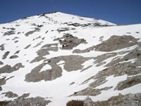
 Krvavac summit (E side) Krvavac summit (E side)
|
| Max altitude : | 2062 m | |
| Total denivelation : | 1100 m | |
| Total distance : | 13800 m | |
| Trekking time : | 4h | |
| Landscape beauty : |  | |
| Physical difficulty : | | |
| Orientation marks : | | |
| Mine risk : | - | |
| Orientation map : | 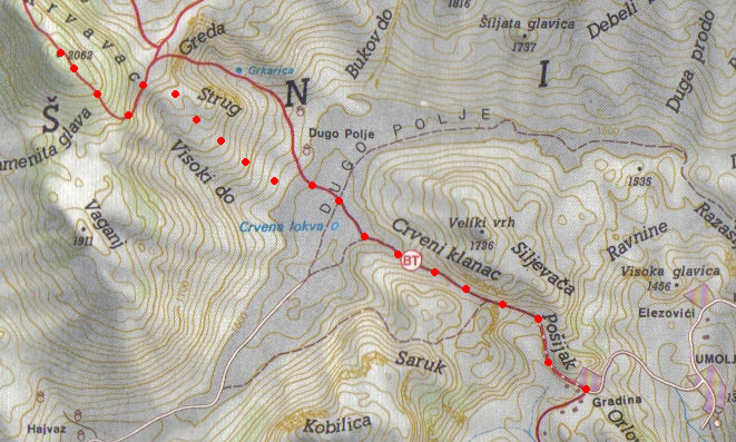 | |
| Denivelation map : | 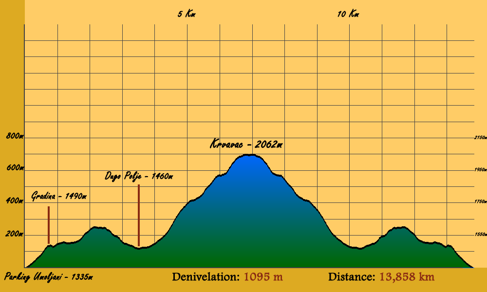 | |
A beautiful trekking until one of the highest summit of Bjelasnica. A physical trekking passing through the wonderful valley "Dugo Polje". |
 It can be complicate to find the start of the path : next to the Marsal hotel in Bjelasnica, you have to continue strike in the main road (coming from Sarajevo), the road will pass throught the mountain in order to go in the valley (south side), continue until the village of Sabici. It can be complicate to find the start of the path : next to the Marsal hotel in Bjelasnica, you have to continue strike in the main road (coming from Sarajevo), the road will pass throught the mountain in order to go in the valley (south side), continue until the village of Sabici.
|
In this village, you have to choose the road going to Umoljani (road in the middle). Maybe 3 or 4 kilometers after, just before a bridge, you have to turn right to follow a little road, continue until Umoljani (first village on this road).
|
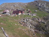
After 1 or 2 minutes, turn to the left and some meters after, again left into a dirt road. The road go until a farmer village, the road can be difficult for an inappropriate car, so you can park as soon as you can. The hiking path start from the farmer village (called Gradina). |
 | 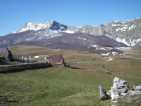 |
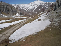
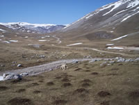
The first step is to reach the "Dugo Polje" valley. From the farmer village, choose the path going to the right to the north-west (the path going to the left go until Lukomir). After around 40 minutes, the path joins a road in the valley.
|
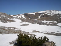
From here, you can start to hike Krvavac, trekking marks are not always visible, but the visibility of the summit permits to find his own way easily with the help of the map.
|
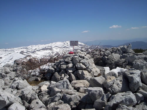
When you reach the summit, you will appreciate the view, don't forget to sign the book placed if the pipe marking the summit.
|
|
|
|