 |
|
|
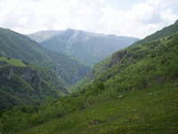
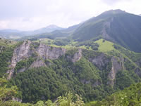
 Rakitnica canyon Rakitnica canyon
|
| Max altitude : | 1400 m | |
| Total denivelation : | 340 m | |
| Total distance : | 7400 m | |
| Trekking time : | 2h30 | |
| Landscape beauty : |  | |
| Physical difficulty : | | |
| Orientation marks : | | |
| Mine risk : | - | |
| Orientation map : | 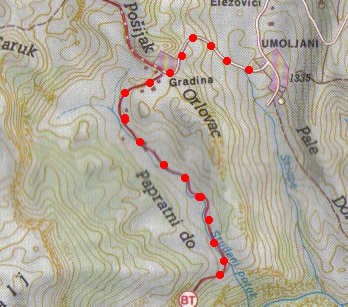 | |
| Denivelation map : | 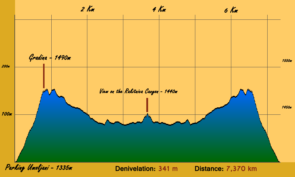 | |
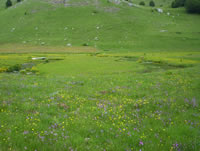
An easy and beautiful trekking. |
 It can be complicate to find the start of the path : next to the Marsal hotel in Bjelasnica, you have to continue strike in the main road (coming from Sarajevo), the road will pass throught the mountain in order to go in the valley (south side), continue until the village of Sabici. It can be complicate to find the start of the path : next to the Marsal hotel in Bjelasnica, you have to continue strike in the main road (coming from Sarajevo), the road will pass throught the mountain in order to go in the valley (south side), continue until the village of Sabici.
|
In this village, you have to choose the road going to Umoljani (road in the middle). Maybe 3 or 4 kilometers after, just before a bridge, you have to turn right to follow a little road, continue until Umoljani (first village on this road).
|
After 1 or 2 minutes, turn to the left and some meters after, again left into a dirt road. You can park your car next to the cemetery. |
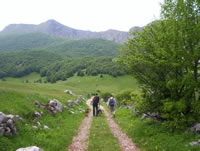
Continue walking until the farmer village, you will have choice between 2 ways, you will have to choose the left one.
|
This way will join a river, following it you will approach the canyon by the north side.
|
|
|
|